Geospatial Data Trends Transforming Global Industries
Introduction to Geospatial Data Trends
Geospatial data has rapidly evolved from static maps and location coordinates into a dynamic source of intelligence that drives innovation across industries. The integration of artificial intelligence, machine learning, and real-time analytics has transformed Geospatial data into a strategic asset for decision-making, operational efficiency, and business growth.
As global industries become increasingly data-driven, staying ahead of geospatial data trends is essential. These trends are reshaping the way organizations approach logistics, urban planning, environmental monitoring, marketing, and more, creating opportunities for smarter, more responsive operations.
The Rise of Real-Time Geospatial Data
IoT and Sensor Networks
The proliferation of Internet of Things (IoT) devices has revolutionized geospatial data collection. Sensors embedded in infrastructure, vehicles, and mobile devices continuously generate real-time location-based data. This provides industries with unprecedented visibility into operations, resource usage, and environmental conditions.
AI-powered platforms analyze this data to optimize workflows, reduce downtime, and improve responsiveness. Industries such as transportation, energy, and manufacturing leverage real-time geospatial data to streamline processes and enhance service delivery.
Dynamic Mapping and Predictive Analytics
Real-time geospatial data enables dynamic mapping, where digital maps continuously update to reflect current conditions. Predictive analytics, powered by AI, allows organizations to forecast traffic patterns, resource demands, and environmental changes.
For example, logistics companies can predict delivery delays due to traffic or weather, while energy providers can anticipate peak demand in specific areas. This trend ensures operational agility and improves decision-making accuracy.
Integration of AI and Machine Learning
Automated Spatial Analysis
Artificial intelligence and machine learning have become key drivers in geospatial data trends. AI algorithms can automatically process massive datasets, identify patterns, and generate insights without extensive human intervention. This automation reduces analysis time and increases precision.
Industries such as agriculture use AI-driven geospatial data to monitor crop health and predict yields, while insurance companies assess risks and optimize coverage using spatial intelligence.
Enhanced Predictive Capabilities
Machine learning enhances predictive capabilities by analyzing historical and real-time geospatial data. Businesses can forecast trends, optimize resource allocation, and plan infrastructure projects with greater accuracy.
For instance, urban planners use predictive geospatial models to design transportation networks and anticipate population growth, ensuring sustainable city development.
Cloud-Based Geospatial Platforms
Scalability and Accessibility
Cloud computing has transformed geospatial data management by providing scalable, cost-effective storage and processing solutions. Organizations can store vast amounts of geospatial information and access it from anywhere, enabling collaboration across departments and regions.
Cloud-based geospatial platforms also allow small and medium-sized enterprises to leverage advanced analytics without heavy investment in infrastructure, democratizing access to location intelligence.
Integration with Big Data Analytics
Cloud platforms facilitate the integration of geospatial data with big data analytics. Combining spatial data with demographic, economic, and operational datasets creates a comprehensive view of markets and operations. AI algorithms process these datasets to reveal trends, correlations, and opportunities that would otherwise remain hidden.
Geospatial Data Visualization and Decision Support
Advanced Mapping Tools
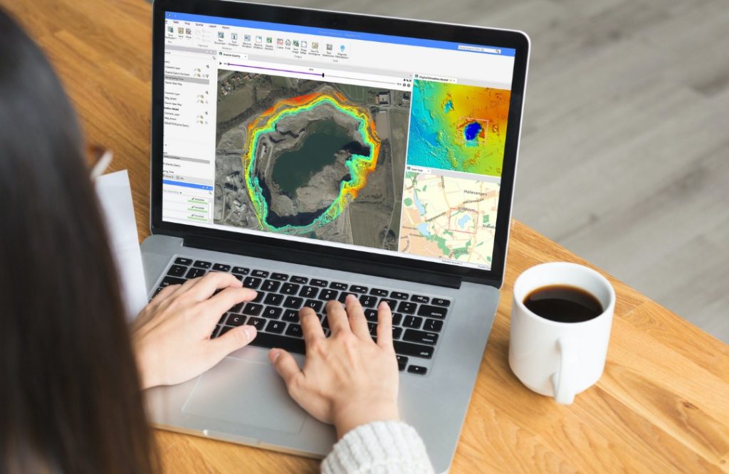
Data visualization is a critical trend in geospatial intelligence. Advanced mapping tools transform complex datasets into interactive maps, heatmaps, and 3D models. These visualizations make spatial relationships and patterns easier to understand, supporting data-driven decisions.
Industries such as real estate, retail, and public health use geospatial visualizations to analyze market potential, assess service coverage, and monitor disease outbreaks in real time.
Decision-Making Dashboards
Geospatial dashboards provide actionable insights by combining maps, analytics, and reporting tools in one interface. Decision-makers can monitor operations, track trends, and respond to emerging issues efficiently. AI enhances these dashboards by offering predictive recommendations and highlighting anomalies in geospatial data.
Industry-Specific Geospatial Data Trends
Transportation and Logistics
The transportation and logistics sector benefits greatly from geospatial data trends. Real-time tracking, route optimization, and predictive delivery models enhance efficiency and reduce costs. AI-driven geospatial data helps logistics companies anticipate delays, optimize fleet utilization, and improve customer satisfaction.
Agriculture and Environmental Management
Precision agriculture relies on geospatial data to monitor soil conditions, crop health, and irrigation needs. AI algorithms analyze satellite and drone imagery to guide planting, fertilization, and harvesting decisions. Environmental organizations also use geospatial trends to track deforestation, monitor water resources, and predict natural disasters.
Retail and Market Analysis
Retailers leverage geospatial data to analyze consumer behavior, identify high-demand regions, and optimize store locations. AI-powered location analysis helps businesses design targeted marketing campaigns, improve inventory distribution, and anticipate customer preferences.
The integration of geospatial trends with customer data drives more personalized, location-based strategies that boost engagement and revenue.
Urban Planning and Smart Cities
Smart city initiatives depend on geospatial data trends to optimize infrastructure, energy distribution, and public services. Real-time spatial data supports traffic management, emergency response, and resource allocation. AI-driven predictive modeling ensures cities can adapt to population growth, climate changes, and urban development challenges effectively.
Challenges in Adopting Geospatial Data Trends
Data Quality and Integration
High-quality geospatial data is essential for accurate analysis. Inconsistent or outdated datasets can lead to incorrect insights and poor decisions. Integrating geospatial data with other business and operational data requires robust frameworks and standardized formats.
Organizations must prioritize data validation, cleaning, and harmonization to leverage geospatial trends effectively.
Privacy and Security Concerns
Geospatial data often contains sensitive location information, raising privacy and security concerns. Industries must comply with regulations, implement encryption, and adopt ethical data usage practices. Ensuring trust while utilizing geospatial insights is a critical consideration for businesses.
Technological Complexity
Advanced geospatial data tools, AI integration, and real-time analytics require technical expertise and infrastructure. Organizations need skilled personnel and robust technology stacks to implement these trends successfully.
The Future of Geospatial Data in Global Industries
Expansion of AI-Driven Geospatial Intelligence
The future will see deeper integration of AI with geospatial data, enabling autonomous decision-making, predictive maintenance, and enhanced operational efficiency. Industries will increasingly rely on AI-driven spatial analysis to gain strategic advantages.
Global Collaboration and Data Sharing
Open geospatial data initiatives and collaborative platforms will facilitate global data sharing. Organizations can leverage shared spatial datasets to address challenges such as climate change, disaster response, and international logistics.
Innovation Across Sectors
Geospatial data trends will continue to drive innovation across sectors, from autonomous transportation and smart cities to personalized retail and precision agriculture. Companies that embrace these trends will unlock new opportunities, optimize operations, and create value in increasingly competitive markets.
Conclusion: Geospatial Data as a Transformative Force
Geospatial data trends are transforming global industries by providing location-based insights that drive innovation, efficiency, and strategic growth. The integration of AI, cloud computing, and advanced visualization tools enhances the value of geospatial intelligence, enabling businesses and governments to make smarter decisions.
Organizations that stay ahead of these trends and adopt geospatial data tools strategically will be better positioned to navigate complex environments, anticipate changes, and achieve sustainable success in the modern data-driven economy.