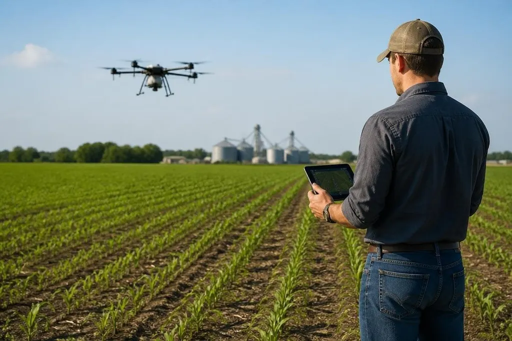
A farming drone can turn a large field into a set of smaller decisions. Its cameras can show where crops are thin, dry, or under stress, giving a farmer a better place to start than a full-field guess.
Quick read
- RGB, multispectral, and thermal cameras show different crop problems.
- Flight maps can guide scouting, spraying, and follow-up checks.
- Better images can support higher yields, but they don't replace field checks or good crop plans.
What a drone can see
An RGB camera records the kind of image your eyes see. It can show gaps in a crop row, standing water, storm damage, and weed patches that need a closer look.
Multispectral cameras add bands of light outside normal human vision. Near-infrared readings can show changes in plant cover before those changes are easy to see from the ground. That gives the farmer a map for closer inspection.
Thermal cameras measure heat at the crop surface. A dry patch may heat up before visible wilting appears, but heat can also come from bare soil, wind, or a different crop stage. The image points to a place to check; it doesn't diagnose the cause by itself.
GPS ties each image to a spot in the field. A farmer can return to that spot, compare later flights, and check whether a repair worked. The useful record is not one colorful map. It is the change between maps taken at different times.
Where the work changes
That record can help with water, weeds, pests, and crop damage. A farmer may inspect a small stressed area before sending a worker across the whole field, then decide whether the problem needs water, treatment, drainage work, or no action.
A drone can also guide targeted spraying. The flight map marks the area that needs attention, while the spray system applies material only where the equipment and local rules allow it.
This can reduce passes across healthy crops, but the drone still needs safe operating space, a trained operator, and a plan for wind and battery changes.
Some drones carry a tank and spray system. Others only collect images. Those are different tools with different safety, payload, and training needs, so a farmer should compare the work the drone must do before comparing camera counts.
A drone’s crop map still leaves questions about soil, weather, and plant health. Agriculture robotics reporting can place field drones beside the other machines used on farms, which sets up the limits of what drone data can tell you alone.
What drones cannot tell you alone
An image can show a pattern without explaining its cause. A pale section may reflect missing nutrients, poor drainage, insect damage, disease, or a camera error. Soil samples, crop walks, weather records, and advice from a crop specialist still matter.
Clouds and wind can also change the result. A camera flight taken under different light may produce maps that are hard to compare, while wind can move leaves and affect spray placement. The same flight height, camera settings, and timing make later checks more useful.
Yield gains are not automatic. A drone can find a problem early, but the farmer still needs the right response and enough time to act. Nobody has shown that buying a drone alone will raise output on every farm.
A buying checklist
Use these checks before choosing a system:
- Map the job: Decide whether the main task is crop images, spray work, or both.
- Check the camera: RGB suits visible damage; multispectral and thermal cameras answer different questions.
- Plan the return visit: Pick a system that records GPS points you can find again on foot or with farm equipment.
- Check local rules: Confirm flight limits, spray rules, operator training, and records before purchase.
- Count the full cost: Include batteries, spare parts, software, storage, training, and time spent reviewing maps.
- Run one field test: Compare the drone map with soil checks and crop walks before using it across the farm.
I'd buy a drone first for repeatable scouting, then add spraying only when the farm has a clear target and a safe operating plan. That order keeps the machine tied to a real crop decision instead of turning it into another screen full of maps.
The next useful proof is simple: compare one mapped field with its harvest record, then see whether the early warning led to a better crop result.